


Lonely Planet
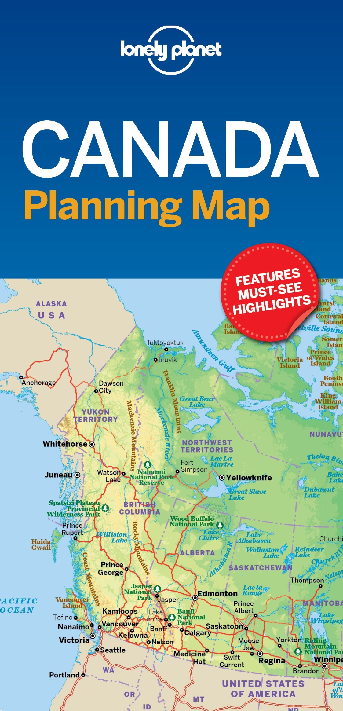
Canada Planning Map
Durable and waterproof, with a handy slipcase and an easy-fold format, Lonely Planet Canada Planning Map is your conveniently-sized passport to traveling with ease. Get more from your map and your trip with images and information about top country attractions, itinerary suggestions, a transport guide, planning information, themed lists and practical travel tips. With this easy-to-use, full colour navigation tool in your back pocket, you can truly get to the heart of Canada, so begin your journey now!
Coverage Includes: Bay of Fundy, Viking Trail, Prince Edward Island, Cabot Trail, Montreal, Quebec City, Charlevoix, Toronto, Ottawa, Niagara Region, Manitoulin Island, Banff National Park, Jasper National Park, Churchill, Drumheller, Vancouver, Haida Gwaii, Dawson City, Nahanni National Park, Baffin Island, Victoria, Goldstream, Tofino, Calgary, Lake Louise
Writers: Lonely Planet
2 pages, 2pp color, 1 maps | Dimensions: 95mm × 197mm
Next edition due: Apr 2024
Add to your travels:
