


Lonely Planet
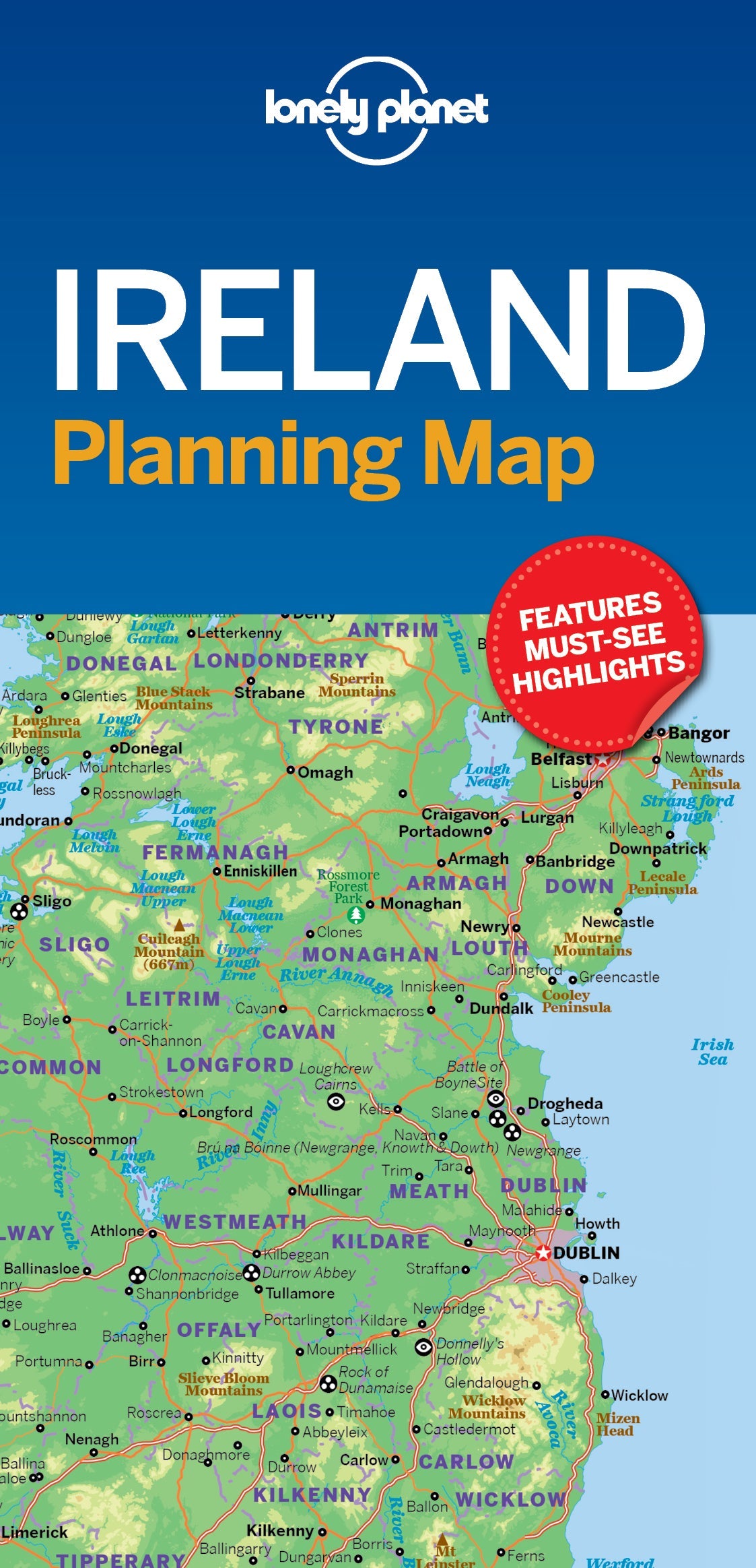
Ireland Planning Map
Durable and waterproof, with a handy slipcase and an easy-fold format, Lonely Planet Ireland Planning Map is your conveniently-sized passport to traveling with ease. Get more from your map and your trip with images and information about top country attractions, itinerary suggestions, a transport guide, planning information, themed lists and practical travel tips. With this easy-to-use, full colour navigation tool in your back pocket, you can truly get to the heart of Ireland, so begin your journey now!
Coverage Includes: Dublin, County Wicklow, Enniskerry, Wicklow Mountains, Glendalough, County Meath, Brú na Bóinne, Cork, Ring of Kerry, Dingle, Cliffs of Moher, The Burren, Adare, Kilkenny, Rock of Cashel, Waterford City, Connemara, Galway City, Ennis, Killarney, Aran Islands, Donegal, Belfast, Causeway Coast, Derry City
Writers: Lonely Planet
2 pages, 2pp color, 1 maps | Dimensions: 95mm × 197mm
Next edition due: Apr 2024
Add to your travels: