


Lonely Planet
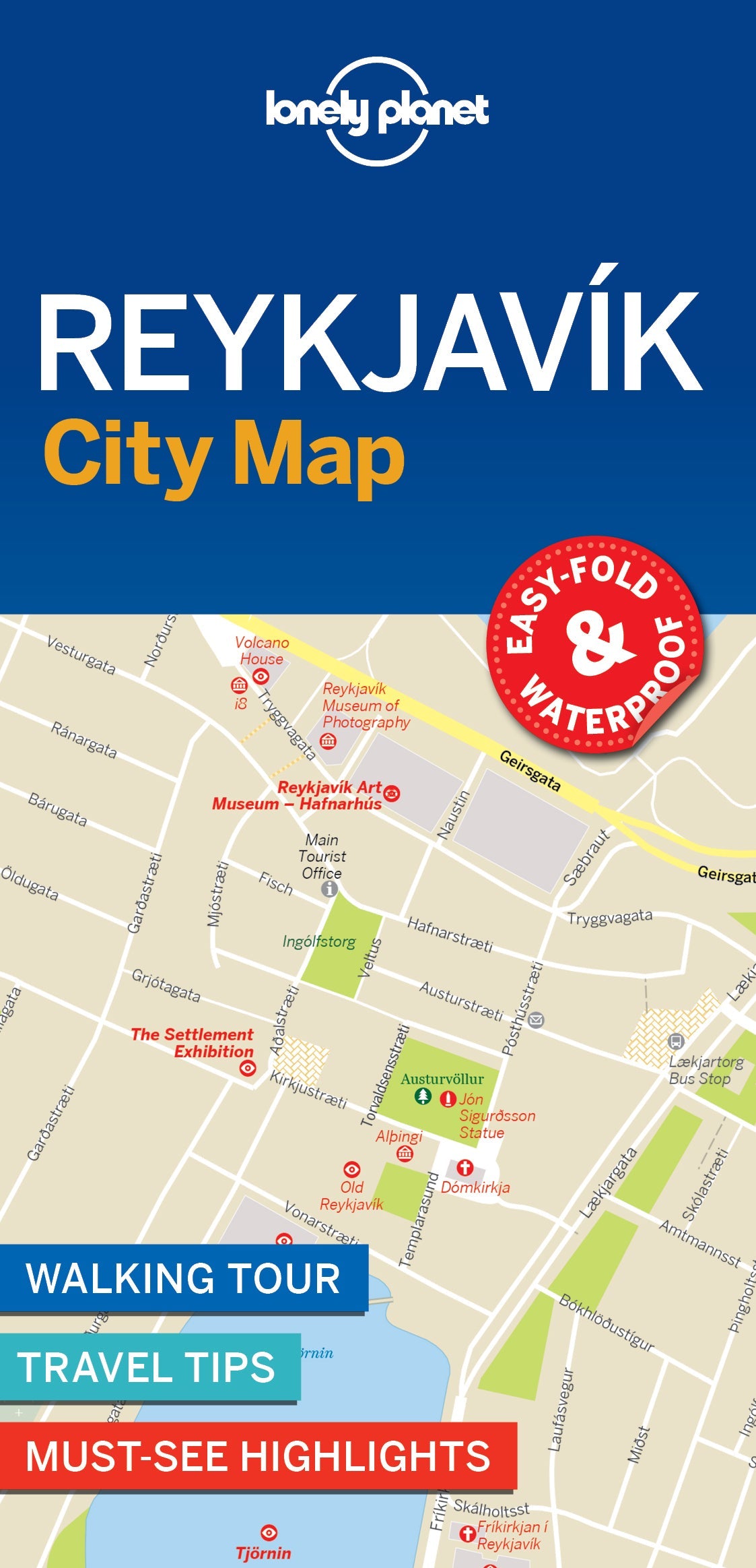
Reykjavik City Map
Durable and waterproof, with a handy slipcase and an easy-fold format, Lonely Planet Reykjavik City Map is your conveniently-sized passport to travelling with ease. Get more from your map and your trip with images and information about top city attractions, walking tour routes, transport maps, itinerary suggestions, extensive street and site index, and practical travel tips and directory. With this easy-to-use, full colour navigation tool in your back pocket, you can truly get to the heart of Reykjavik, so begin your journey now!
Coverage Includes: Old Reykjavik, Old Harbour, Laugavegur & Skolavordustigur, Golden Circle, Thingvellir National Park, Geysir, Gullfoss
Add to your travels:
You are viewing a Planning Map
What is a Planning Map?
Whether you're exploring a country or an entire continent, our durable and waterproof Planning maps come in an easy-fold design held inside a handy slipcase. Detailed and easy-to-read, they're printed in full colour to make travelling and trip planning a breeze. Country-focused, these show a whole nation at a glance, as well as its top regional sights and themed highlights