


Lonely Planet
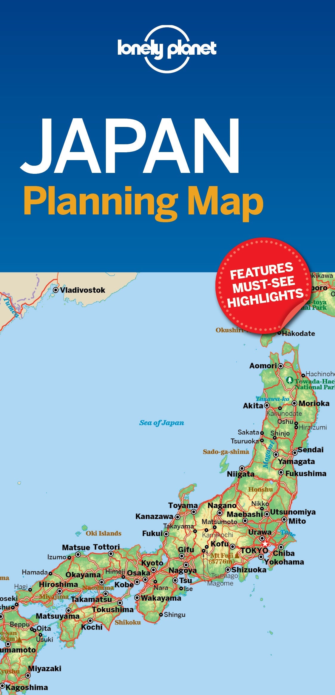
Japan Planning Map
Durable and waterproof, with a handy slipcase and an easy-fold format, Lonely Planet Japan Planning Map is your conveniently-sized passport to traveling with ease. Get more from your map and your trip with images and information about top country attractions, itinerary suggestions, a transport guide, planning information, themed lists and practical travel tips. With this easy-to-use, full colour navigation tool in your back pocket, you can truly get to the heart of Japan, so begin your journey now!
Coverage Includes: Tokyo, Mt Fuji, Izu Peninsula, Nikko, Kyoto, Nara, Osaka, Koya-san, Naoshima, Himeji, Hiroshima, Miyajima, Kagoshima, Matsuyama, Fukuoka, Takayama, Tsumago, Magone, Kanazawa, Kamikochi, Sapporo, Niseko, Shikotsu-Toya National Park, Matsushima
Add to your travels:
