


Lonely Planet
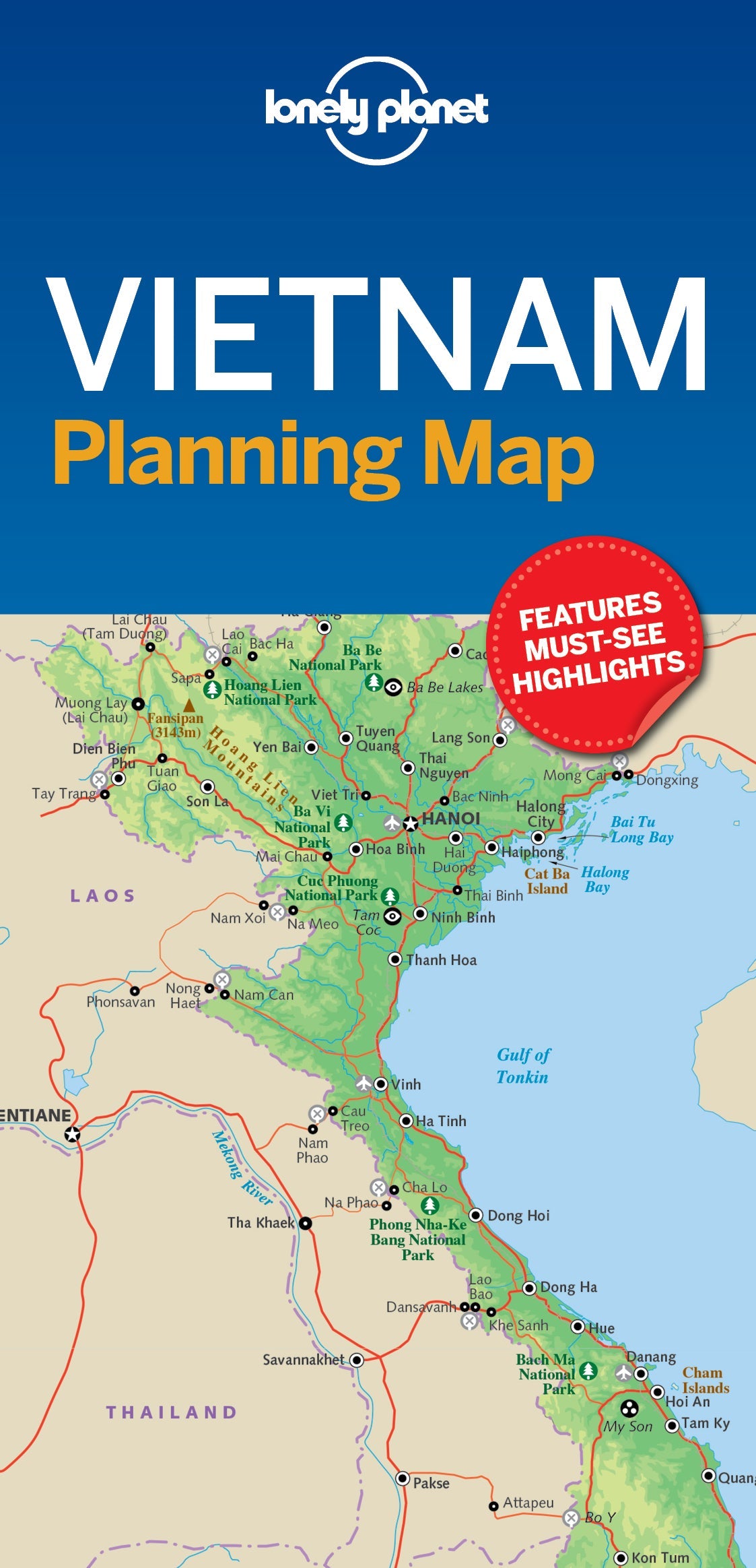
Vietnam Planning Map
Durable and waterproof, with a handy slipcase and an easy-fold format, Lonely Planet Vietnam Planning Map is your conveniently-sized passport to traveling with ease.
Get more from your map and your trip with images and information about top country attractions, itinerary suggestions, a transport guide, planning information, themed lists and practical travel tips. With this easy-to-use, full colour navigation tool in your back pocket, you can truly get to the heart of Vietnam, so begin your journey now!
Coverage Includes: Hanoi, Halong Bay, Ha Giang Province, Sapa, Hoi An, Phong Nha-Ke Bang National Park, Hue, DMZ, Con Dao Islands, Mui Ne, Bai Xep, Ho Chi Minh City, Cu Chi, Cat Tien National Park, Dalat, Kon Tum, Phu Quoc Island, Can Tho, Sam Mountain
ISBN: 9781787014565
Writers: Lonely Planet
2 pages, 2pp color, 1 maps | Dimensions: 95mm × 197mm
Next edition due: Jul 2025
Writers: Lonely Planet
2 pages, 2pp color, 1 maps | Dimensions: 95mm × 197mm
Next edition due: Jul 2025
Add to your travels:

You are viewing a Planning Map
What is a Planning Map?
Whether you're exploring a country or an entire continent, our durable and waterproof Planning maps come in an easy-fold design held inside a handy slipcase. Detailed and easy-to-read, they're printed in full colour to make travelling and trip planning a breeze. Country-focused, these show a whole nation at a glance, as well as its top regional sights and themed highlights